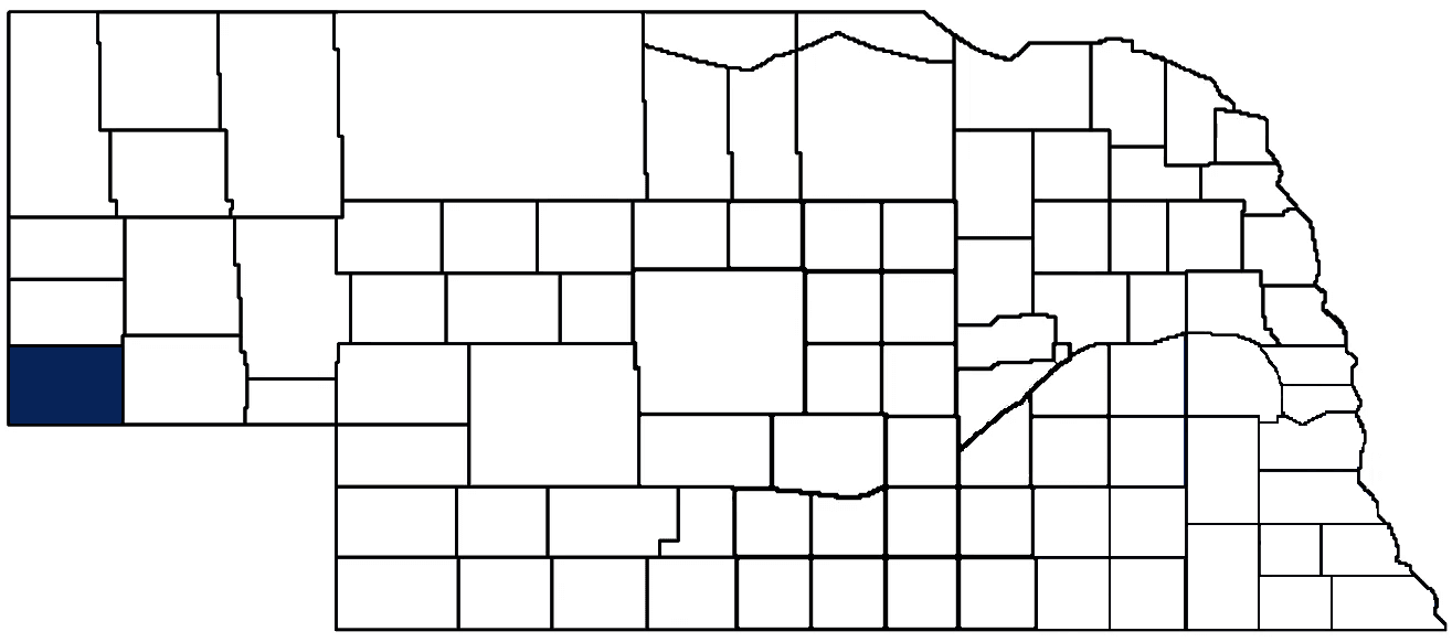
- General Info
- Demographics
- Education and Employment
- Valuation and Taxes Levied
- State Senators
- History
- County Programs
- Other Information
Communities and Development
Kimball County Seat: Kimball
Total County Population (2020): 3,434
- Cities (pop. & class): Kimball (2,290 • 2nd Class)
- Villages (pop.): Bushnell (115), Dix (187)
- Unincorporated Pop. (% of county pop.): 842 (25%)
Land Development (2022) (% of total land in county):
- Agriculture: 84%
- By method: Dryland (row crop/grain/forage) (39%); Pasture (pure grassland) (38%); Irrigated (row crop/grain/forage) (7%) • Neb. Dept. of Rev. - total equals agriculture's %
- By commodity: Livestock (grassland) 56%, Wheat 13%, Millet 6%, Corn 5%, Alfalfa 2%, Other Hay 2% • USDA - equals agriculture's % plus some fallow land (13%) and some wetlands (0.25%) and minus public grassland/wetlands and reserve
- Residential, Commercial, Industrial, Conservation Reserve & Exempt (combined): 16%
County Offices
Courthouse Address and Hours:
114 East 3rd Street
Kimball, Nebraska 69145
M-Th 8:00 am - 5:00 pm & 8:00 am - 4:00 pm Friday
County Board Chairperson: Rich Flores
Complete list of county board members
County Board Meetings: 1st & 3rd Tuesday
View the County's Government Maps
NACO District: Panhandle
District President: Rich Flores, Kimball County Commissioner
District Vice President: Susanna Batterman, Morrill County Commissioner
District Secretary: Kelly Sides, Scotts Bluff County Clerk
District Treasurer: Beth Fiegenschuh, Cheyenne County Clerk
NACO Board Representatives: Steve Burke, Box Butte County Commissioner
General
Population: 3,434
Land area (sq. mi.): 951.94
Population per square mile: 3.6
Race
Race
White: 88.1%
African American: 0.0%
American Indian: 0.7%
Asian: 0.4%
Hispanic: 7.6%
Native Hawaiian and Pacific Islander: 0.0%
Two or More Races: 2.8%
Age
0-17: 20.7%
18-64: 53.6%
65+: 25.8%
Socioeconomics
Personal income per capita: $55,021
% of Population in Poverty: 11.0%
# of Housing Units: 1,805
Owner-occupied rate: 73.1%
Median home price: $95,080
Technology
Access to broadband (100 Mbps via fiber or cable modem): 67.2%
Sources: National Association of Realtors, Nebraska Library Commission, U.S. Bureau of Economic Analysis, U.S. Census Bureau
Employment, Schools, and Child Care
Unemployment rate: 1.7% (as of September 2022)
County Employment Website: https://nebraskacounties.org/nebraska-counties/county-employment-opportunities.html
High school graduate or higher: 89.8%
School Districts: Kimball Public Schools, Potter-Dix Public Schools
Bachelor's degree or higher: 13.2%
Community College Service Area: Western Community College
Countywide child care capacity: 3 providers; 32 children
Find child care: For a list of child care providers in your zip code, visit Nebraska DHHS or the Nebraska Resource and Referral System.
Kimball County Economy
Annual Gross Domestic Product (2020): $191,316,000
Cattle Producers: 100
- Pastureland Cash Rent (avg.): $134/acre/yr
Crop Producers: 83
Grain Co-ops and Purchasers: FVC, Panhandle Coop System
Local Grain Market: Click for today's grain prices in Kimball County
Oil Wells Producing (barrels of oil/yr): 136 wells (228,693 barrels)
Electricity Providers: City of Kimball, High West Energy
Wind Turbines Operating (MW): 12 turbines (30,000 MW)
Rail-served Communities: Bushnell, Dix, Kimball
Well Locations (Irrigation/Livestock), Soils, Groundwater & Surface Water
Total Irrigation/Livestock Wells: 491
Surface Water Diversions (Irrigation): 35
Click for real time:
Streamflow data on Lodgepole Creek at Bushnell
Groundwater level data near U.S. Hwy 30 & Rd. 13 W. (2.5 mi. southwest of Bushnell)
Sources: National Agricultural Statistics Service (USDA), Nebraska Cooperative Council, Nebraska Coordinating Commission for Postsecondary Education, Nebraska Department of Transportation, Nebraska Office of the CIO, Nebraska Power Review Board, U.S. Bureau of Economic Analysis, U.S. Bureau of Labor Statistics, U.S. Census Bureau
2022 Levies and Valuation
County levy rate: $0.4593 per $100 of taxable valuation
County property taxes levied: $3,328,274
Total local government property taxes levied: $12,707,521
Total countywide taxable valuation: $724,574,423
Click here for all levy rates in Kimball County
County Levy and Taxation Laws
Levy limits
Since 1996, counties and other political subdivisions have been subject to the levy limits listed in Neb. Rev. Stat. § 77-3442 and Neb. Rev. Stat. § 77-3443.
Statutes and regulations
Nebraska Revised Statutes (Chapter 77)
Nebraska Administrative Code (Title 350)
Local tax reductions, exemptions, and credits
Neb. Rev. Stat. § 76-902(5)(a) (Deed "stamp tax" exemption): "The [stamp tax] shall not apply to: ... (5)(a) Deeds between spouses, between ex-spouses for the purpose of conveying any rights to property acquired or held during the marriage, or between parent and child, without actual consideration therefor."
Neb. Rev. Stat. § 77-201(2) (Valuation of agricultural land and horticultural land): "Agricultural land and horticultural land as defined in section 77-1359 shall constitute a separate and distinct class of property for purposes of property taxation, shall be subject to taxation, unless expressly exempt from taxation, and shall be valued at seventy-five percent of its actual value, except that for school district taxes levied to pay the principal and interest on bonds that are approved by a vote of the people on or after January 1, 2022, such land shall be valued at fifty percent of its actual value."
Neb. Rev. Stat. § 77-6703(1) (Tax credit for school district taxes paid): "(1) For taxable years beginning or deemed to begin on or after January 1, 2020, under the Internal Revenue Code of 1986, as amended, there shall be allowed to each eligible taxpayer a refundable credit against the income tax imposed by the Nebraska Revenue Act of 1967 or against the franchise tax imposed by sections 77-3801 to 77-3807. The credit shall be equal to the credit percentage for the taxable year, as set by the department under subsection (2) of this section, multiplied by the amount of school district taxes paid by the eligible taxpayer during such taxable year."
Sources: Nebraska Department of Revenue
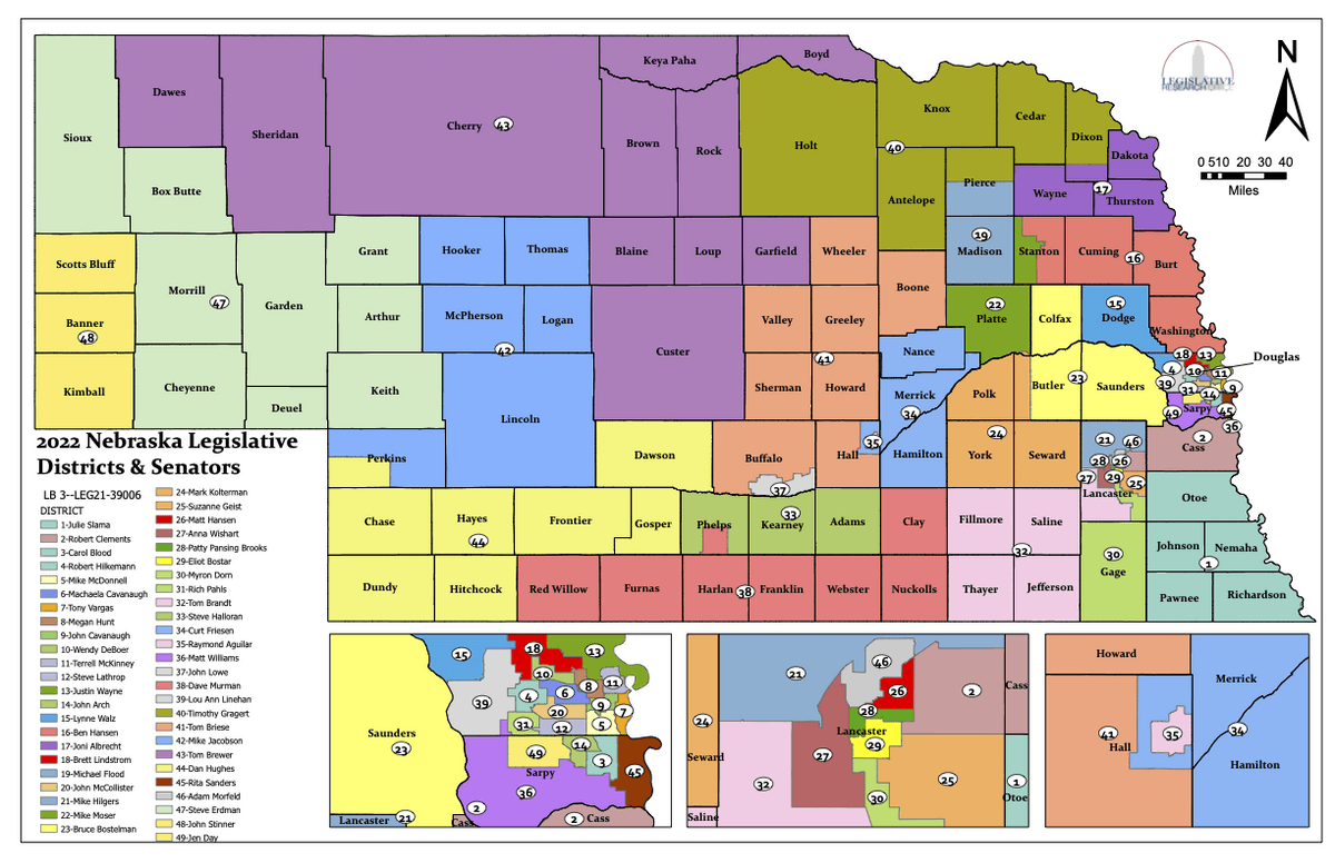
State Senator: Brian Hardin (District 48)
Standing Committees (click for scheduled committee hearings):
- Health and Human Services (vice chairperson)
- General Affairs
- Nebraska Retirement Systems
- Urban Affairs
Map and statistics for Legislative District 48
Map of all districts in the Nebraska Unicameral Legislature
Kimball County History
Number of Registered Historic Places: 5
Year Authorized: 1888
Year Organized: 1888
Etymology: Thomas Kimball (General Manager of the Union Pacific Railroad)
The first settlement in Kimball County was called Antelopesville, after the abundant antelope in the area. However, residents changed the name to Kimball in 1885 once they discovered there was already a post office in the state called Antelopesville. Kimball would become the county seat when the western third of Cheyenne County was divided into three counties in 1888, one of which was called Kimball (the other two counties were Banner and Scotts Bluff). Kimball County was named in honor of Thomas L. Kimball, the vice president and general manager of the Union Pacific Railroad which passed through the area in the 1860’s. In addition to the railroad, the Kincaid Act of 1904 brought many settlers to the area, primarily farmers, but also ranchers. The dark soil proved good for farming while the native grasses fed cattle.
Kimball County has had two courthouses, the most recent of which opened 1928. Constructed from Carthage stone and featuring floors of Ozark gray marble and solid walnut fixtures, the courthouse cost $180,000 (approximately $3.1 million today).
Kimball County claims the highest point of elevation in the state—Panorama Point, 5,424 feet above sea level, which is located in the southwest corner of the county where Nebraska, Colorado and Wyoming intersect. Kimball County was also once home to the world's largest complex of Intercontinental Ballistic Missiles (ICBMs), earning the county the title of "Missile Center of the United States." Kimball has also been known as “Nebraska’s Oil Capital.” As late as the 1980’s, the county featured over 1,400 active wells.
Highlight an important program in your county in this space! Send an email to:
Local Highlights
License Plate Number: 71
Time Zone: Mountain
Number of Veterans: 314
Zoned County: Yes
County Hospital: Kimball County Hospital
Number of County-Owned Bridges: 42
Election Data
General Election Turnout (2022): 50.92%
Total Registered Voters (2020): 2,786
Number of Precincts (2020): 5
Number of Election Day Polling Places (2020): 3
Land Area per Polling Place (2020): 317.31 sq. miles
Intergovernmental Data
Emergency Mgt. Planning, Exercise and Training (PET) Region: Panhandle
Natural Resource District: South Platte NRD
Sources: Nebraska Department of Transportation, Nebraska Emergency Management Agency, Nebraska Game & Parks Commission, Nebraska Legislature, Nebraska Office of the CIO, Nebraska Secretary of State, U.S. Department of Veterans Affairs, U.S. National Archives and Records Administration (eCFR)