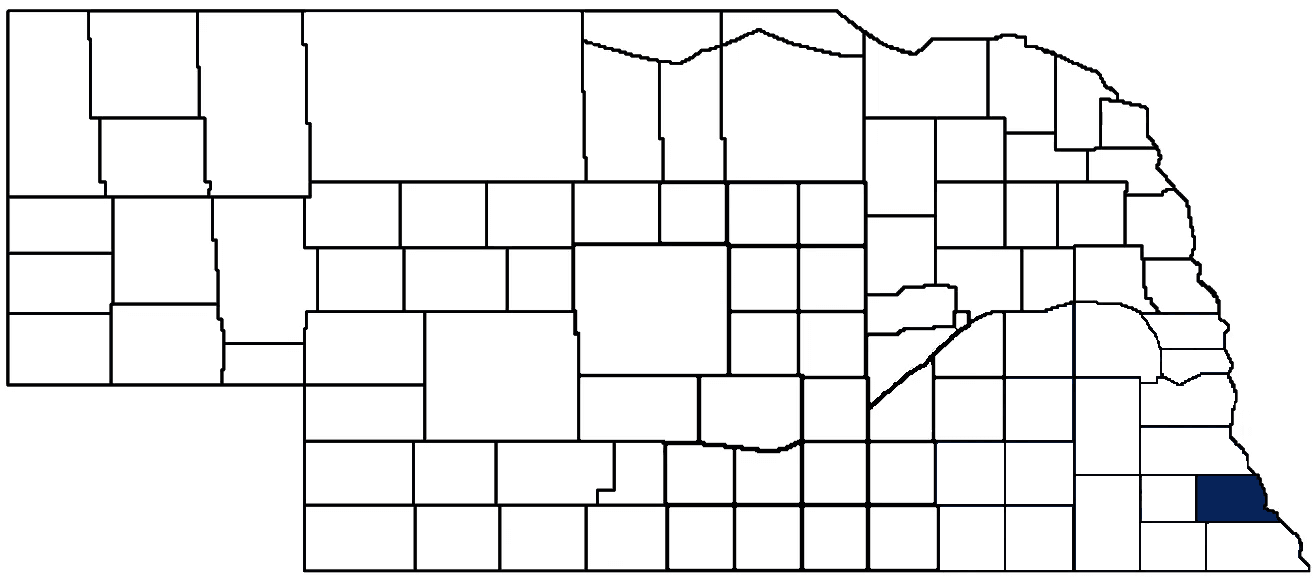
- General Info
- Demographics
- Education and Employment
- Valuation and Taxes Levied
- State Senators
- History
- County Programs
- Other Information
Communities and Development
Nemaha County Seat: Auburn
Total County Population (2020): 7,074
- Cities (pop. & class): Auburn (3,470 • 2nd Class), Peru (648 • 2nd Class)
- Villages (pop.): Brock (123), Brownville (139), Johnson (309), Julian (46), Nemaha (114)
- Unincorporated Pop. (% of county pop.): 2,225 (31%)
Land Development (2022) (% of total land in county):
- Agriculture: 78%
- By method: Dryland (row crop/grain/forage) (66%); Pasture (pure grassland) (8%); Irrigated (row crop/grain/forage) (5%) • Neb. Dept. of Rev. - total equals agriculture's %
- By commodity: Soybeans 38%, Corn 33%, Livestock (grassland) 10%, Other Hay 1%, Alfalfa 0.5% • USDA - equals agriculture's % plus some wetlands (2%) and minus public grassland/wetlands and reserve
- Residential, Commercial, Industrial, Conservation Reserve & Exempt (combined): 14%
- Timber: 8%
County Offices
Courthouse Address and Hours:
1824 N Street
Auburn, Nebraska 68305
M-F 8:00 am - 5:00 pm
County Board Chairperson: Michael Weiss
Complete list of county board members
County Board Meetings: Every other Wednesday
View the County's Government Maps
NACO District: Southeast
President: Misty Ahmic, Seward County Commissioner
Vice President: Patty McEvoy, Saunders County Clerk of the District Court
Secretary/Treasurer: Amber Mulberry, Saline County Clerk of the District Court
NACO Board Representative: Mark Schoenrock, Jefferson County Commissioner
General
Population: 7,064
Land area (sq. mi.): 407.38
Population per square mile: 17.4
Race and Age
Race
White: 92.4%
African American: 0.8%
American Indian: 0.4%
Asian: 0.4%
Hispanic: 2.9%
Native Hawaiian and Pacific Islander: 0.0%
Two or More Races: 2.8%
Age
0-17: 22.8%
18-64: 57.0%
65+: 20.2%
Socioeconomics
Personal income per capita: $56,823
% of Population in Poverty: 11.8%
# of Housing Units: 3,312
Owner-occupied rate: 72.1%
Median home price: $114,810
Technology
Access to broadband (100 Mbps via fiber or cable modem): 64.3%
Sources: National Association of Realtors, Nebraska Library Commission, U.S. Bureau of Economic Analysis, U.S. Census Bureau
Employment, Schools, and Child Care
Unemployment rate: 2.1% (as of September 2022)
County Employment Website: https://www.adamscounty.org/employment
High school graduate or higher: 91.1%
School Districts: Auburn Public Schools, Falls City Public Schools, Humboldt Table Rock Steinauer, Johnson-Brock Public Schools, Johnson County Central Public Schools, Nebraska City Public Schools
Bachelor's degree or higher: 28.0%
Community College Service Area: Southeast Community College
Countywide child care capacity: 13 providers; 285 children
Find child care: For a list of child care providers in your zip code, visit Nebraska DHHS or the Nebraska Resource and Referral System.
Nemaha County Economy
Annual Gross Domestic Product (2020): $728,791,000
Cattle Producers: 101
- Pastureland Cash Rent (avg.): $40/acre
Crop Producers: 43
- Dryland Cash Rent (avg.): $144/acre
- Irrigated Land Cash Rent (avg.): $290/acre
Grain Co-ops and Purchasers: Farmers Union Coop, Frontier
Local Grain Market: Click for today's grain prices in Nemaha County
Farmers Market:
- Auburn Street Market (May - September, Thursdays 4:30 - 7:30 p.m.)
- Nemaha County Farmers Market (Auburn) (June - October, Saturdays 7:30 - 11:00 a.m.)
Electricity Providers: Auburn Board of Public Works, City of Nebraska City, Nebraska PPD, Omaha PPD
Rail-served Communities: Auburn, Howe, Julian
Well Locations (Irrigation/Livestock), Soils, Groundwater & Surface Water
Total Irrigation/Livestock Wells: 176
Surface Water Diversions (Irrigation): 103
Click for real time:
Streamflow data on the Little Nemaha River at Auburn
Sources: National Agricultural Statistics Service (USDA), Nebraska Cooperative Council, Nebraska Coordinating Commission for Postsecondary Education, Nebraska Department of Transportation, Nebraska Office of the CIO, Nebraska Power Review Board, U.S. Bureau of Economic Analysis, U.S. Bureau of Labor Statistics, U.S. Census Bureau
2022 Levies and Valuation
County levy rate: $0.3351 per $100 of taxable valuation
County property taxes levied: $4,048,308
Total local government property taxes levied: $18,227,603
Total countywide taxable valuation: $1,208,226,989
Federal PILT payment to Holt County (FY2022): $10,110 regarding 3,441 federally-owned acres
Click here for all levy rates in Nemaha County
County Levy and Taxation Laws
Levy limits
Since 1996, counties and other political subdivisions have been subject to levy limits under Neb. Rev. Stat. § 77-3442 and Neb. Rev. Stat. § 77-3443.
Statutes and regulations
Nebraska Revised Statutes (Chapter 77)
Nebraska Administrative Code (Title 350)
Local tax reductions, exemptions, and credits
Neb. Rev. Stat. § 76-902(5)(a) (Deed "stamp tax" exemption): "The [stamp tax] shall not apply to: ... (5)(a) Deeds between spouses, between ex-spouses for the purpose of conveying any rights to property acquired or held during the marriage, or between parent and child, without actual consideration therefor."
Neb. Rev. Stat. § 77-201(2) (Valuation of agricultural land and horticultural land): "Agricultural land and horticultural land as defined in section 77-1359 shall constitute a separate and distinct class of property for purposes of property taxation, shall be subject to taxation, unless expressly exempt from taxation, and shall be valued at seventy-five percent of its actual value, except that for school district taxes levied to pay the principal and interest on bonds that are approved by a vote of the people on or after January 1, 2022, such land shall be valued at fifty percent of its actual value."
Neb. Rev. Stat. § 77-6703(1) (Tax credit for school district taxes paid): "(1) For taxable years beginning or deemed to begin on or after January 1, 2020, under the Internal Revenue Code of 1986, as amended, there shall be allowed to each eligible taxpayer a refundable credit against the income tax imposed by the Nebraska Revenue Act of 1967 or against the franchise tax imposed by sections 77-3801 to 77-3807. The credit shall be equal to the credit percentage for the taxable year, as set by the department under subsection (2) of this section, multiplied by the amount of school district taxes paid by the eligible taxpayer during such taxable year."
Sources: Nebraska Department of Revenue
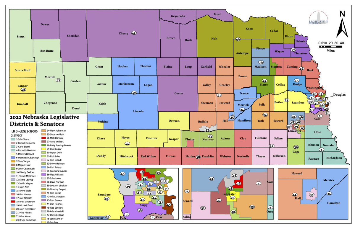
State Senator: Julie Slama (District 1)
Standing Committees (click for scheduled committee hearings):
- Banking, Commerce and Insurance (chairperson)
- Natural Resources
- Government, Military and Veterans Affairs
Select Committees:
- Reference
Special Committees:
- Executive Board of the Legislative Council
Map and statistics for Legislative District 1
Map of all districts in the Nebraska Unicameral Legislature
Nemaha County History
Number of Registered Historic Places: 13
Year Authorized: 1855
Year Organized: 1855
Etymology: Nemaha Native American tribe
Another of Nebraska's counties that derives its name from Indian lore is Nemaha County. Years before the first white settlers, the Otoe Indians inhabited this area along the Missouri River. A stream which crossed the land and emptied into the Missouri was referred to by the Otoes as the miry water river. The Otoe name was Nimaha, ni meaning water and maha meaning miry. That name evolved into Nemaha.
Nemaha County was originally called Forney County, one of the eight original counties to make up the Nebraska Territory. Forney County's boundaries were defined in October 1854. The following year, in the first session of the Territorial Legislature, the county was reorganized and its name changed to Nemaha.
In 1854, Richard W. Brown became one of the first pioneers in the area. Brown crossed the Missouri River in a canoe and laid out a cabin claim along the west bank. Within two years the town of Brownville was surveyed and platted. Brown's original log cabin would serve as the county's courthouse until 1867.
There is an interesting history behind the present county seat of Auburn. Originally there were two settlements here -- Sheridan to the north and Calvert to the south. Sheridan was surveyed in October 1868 and named in honor of Civil War Gen. Phil S. Sheridan. Calvert was platted in July 1881 and named for Thomas E. Calvert, an official with the Burlington and Missouri River Railroad. The two rival towns agreed to unite and form one town in 1882. New York native Charles Nixon, who had an interest in the land through which the railroad ran, suggested the unified town be known as Auburn, after Auburn, N.Y.
According to historical accounts, a frame courthouse was built in the middle of the two former towns. For many years this united town would be referred to as North Auburn and South Auburn.
The original frame courthouse would soon be replaced when in 1900 the cornerstone was laid for the present courthouse.
Highlight an important program in your county in this space! Send an email to:
Local Highlights
License Plate Number: 44
Time Zone: Central
Number of Veterans: 566
Zoned County: No
County Hospital: Nemaha County Hospital
Number of County-Owned Bridges: 139
Number of County-Owned Dams: 1
Election Data
General Election Turnout (2022): 54.17%
Total Registered Voters (2020): 4,386
Number of Precincts (2020): 9
Number of Election Day Polling Places (2020): 8
Land Area per Polling Place (avg.) (2020): 50.92 sq. miles
Intergovernmental Data
Emergency Mgt. Planning, Exercise and Training (PET) Region: Southeast
Natural Resource Districts: Nemaha NRD
State Lands (acres): Aspinwall Bend WMA (160.97), Indian Cave State Park (3,399.70 Nemaha & Richardson), Peru Bottoms WMA (854.04), Peru State College (104)
Federal Lands (acres): Brownville Bend (469), Kansas Bend (1,175), Langdon Bend (1,781), Peru Boat Ramp (4), Sonora Bend (189)
Sources: Nebraska Department of Transportation, Nebraska Emergency Management Agency, Nebraska Game & Parks Commission, Nebraska Legislature, Nebraska Office of the CIO, Nebraska Secretary of State, U.S. Department of Veterans Affairs, U.S. National Archives and Records Administration (eCFR)