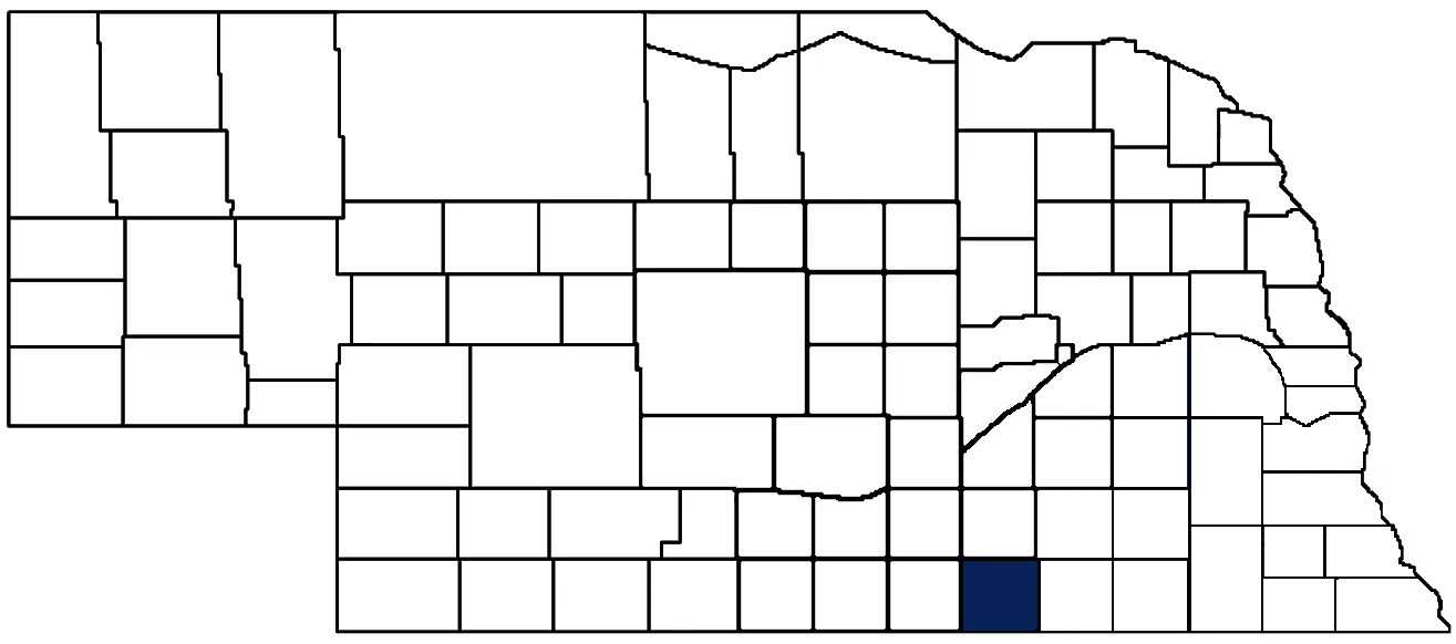
- General Info
- Demographics
- Education and Employment
- Valuation and Taxes Levied
- State Senators
- History
- County Programs
- Other Information
Communities and Development
Nuckolls County Seat: Nelson
Total County Population (2020): 4,095
- Cities (pop. & class): Nelson (456 • 2nd Class), Superior (1,825 • 2nd Class)
- Villages (pop.): Hardy (97), Lawrence (272), Nora (21), Oak (54), Ruskin (105)
- Unincorporated Pop. (% of county pop.): 1,265 (31%)
Land Development (2022) (% of total land in county):
- Agriculture: 92%
- By method: Dryland (row crop/grain/forage) (43%); Pasture (pure grassland) (29%); Irrigated (row crop/grain/forage) (20%) • Neb. Dept. of Rev. - total equals agriculture's %
- By commodity: Corn 36%, Livestock (grassland) 29%, Soybeans 22%, Wheat 2%, Alfalfa 1%, Sorghum 1% • USDA - equals agriculture's % plus some wetlands (1%) and minus public grassland/wetlands and reserve
- Residential, Commercial, Industrial, Conservation Reserve & Exempt (combined): 6%
- Timber: 2%
County Offices
Courthouse Address and Hours:
150 South Main Street
Nelson, Nebraska 68961
M-F 8:30 am - 4:30 pm
County Board Chairperson: Tim Zikmund
Complete list of county board members
County Board Meetings: 1st & 3rd Monday
View the County's Government Maps
NACO District: Central
District President: Carrie Miller, Nuckolls County Clerk, Register of Deeds, Election Commissioner
District Vice President: Kali Bolli, Garfield County Assessor
District Secretary/Treasurer: Cara Snider Wheeler County Clerk
NACO Board Representatives: Bill Maendele, Buffalo County Commissioner
General
Population: 4,060
Land area (sq. mi.): 575.16
Population per square mile: 7.1
Race and Age
Race
White: 93.7%
African American: 0.1%
American Indian: 0.1%
Asian: 0.1%
Hispanic: 2.9%
Native Hawaiian and Pacific Islander: 0.0%
Two or More Races: 2.9%
Age
0-17: 20.2%
18-64: 52.5%
65+: 27.2%
Socioeconomics
Personal income per capita: $68,062
% of Population in Poverty: 9.8%
# of Housing Units: 2,216
Owner-occupied rate: 78.6%
Median home price: $87,290
Technology
Access to broadband (100 Mbps via fiber or cable modem): 60.4%
Sources: National Association of Realtors, Nebraska Library Commission, U.S. Bureau of Economic Analysis, U.S. Census Bureau
Employment, Schools, and Child Care
Unemployment rate: 1.7% (as of September 2022)
County Employment Website: https://nuckollscounty.ne.gov/about-us/
High school graduate or higher: 92.8%
School Districts: Bruning-Davenport Unified System, Deshler Public Schools, Superior Public Schools, Thayer Central Community Schools, South Central Nebraska Unified 5
Bachelor's degree or higher: 23.5%
Community College Service Area: Central Community College
Countywide child care capacity: 5 providers; 108 children
Find child care: For a list of child care providers in your zip code, visit Nebraska DHHS or the Nebraska Resource and Referral System.
Nuckolls County Economy
Annual Gross Domestic Product (2020): $237,644,000
Cattle Producers: 221
- Pastureland Cash Rent (avg.): $30/acre
Crop Producers: 162
- Dryland Cash Rent (avg.): $53/acre
- Irrigated Land Cash Rent (avg.): $241/acre
Dairy Producers: 2
Grain Co-ops and Purchasers: Aurora Cooperative, CPI
Local Grain Market: Click for today's grain prices in Nuckolls County
Farmers Market: Superior Farmers Market (Saturdays 8:00 a.m. - 11:00 a.m.)
Electricity Providers: City of Nelson, City of Superior, South Central PPD
Rail-served Communities: Superior
Well Locations (Irrigation/Livestock), Soils, Groundwater & Surface Water
Total Irrigation/Livestock Wells: 993
Surface Water Diversions (Irrigation): 195
Click for real time:
Streamflow data on the Courtland Canal at the Nebraska-Kansas Stateline
Streamflow data on the Little Blue River near Deweese
Sources: National Agricultural Statistics Service (USDA), Nebraska Cooperative Council, Nebraska Coordinating Commission for Postsecondary Education, Nebraska Department of Transportation, Nebraska Office of the CIO, Nebraska Power Review Board, U.S. Bureau of Economic Analysis, U.S. Bureau of Labor Statistics, U.S. Census Bureau
2022 Levies and Valuation
County levy rate: $0.2685 per $100 of taxable valuation
County property taxes levied: $3,097,677
Total local government property taxes levied: $15,103,499
Total taxable valuation: $1,153,647,355
Federal PILT payment to Nuckolls County (FY2022): $2,638 regarding 898 federally-owned acres
Click here for all levy rates in Nuckolls County
County Levy and Taxation Laws
Levy limits
Since 1996, counties and other political subdivisions have been subject to the levy limits listed in Neb. Rev. Stat. § 77-3442 and Neb. Rev. Stat. § 77-3443.
Statutes and regulations
Nebraska Revised Statutes (Chapter 77)
Nebraska Administrative Code (Title 350)
Local tax reductions, exemptions, and credits
Neb. Rev. Stat. § 76-902(5)(a) (Deed "stamp tax" exemption): "The [stamp tax] shall not apply to: ... (5)(a) Deeds between spouses, between ex-spouses for the purpose of conveying any rights to property acquired or held during the marriage, or between parent and child, without actual consideration therefor."
Neb. Rev. Stat. § 77-201(2) (Valuation of agricultural land and horticultural land): "Agricultural land and horticultural land as defined in section 77-1359 shall constitute a separate and distinct class of property for purposes of property taxation, shall be subject to taxation, unless expressly exempt from taxation, and shall be valued at seventy-five percent of its actual value, except that for school district taxes levied to pay the principal and interest on bonds that are approved by a vote of the people on or after January 1, 2022, such land shall be valued at fifty percent of its actual value."
Neb. Rev. Stat. § 77-6703(1) (Tax credit for school district taxes paid): "(1) For taxable years beginning or deemed to begin on or after January 1, 2020, under the Internal Revenue Code of 1986, as amended, there shall be allowed to each eligible taxpayer a refundable credit against the income tax imposed by the Nebraska Revenue Act of 1967 or against the franchise tax imposed by sections 77-3801 to 77-3807. The credit shall be equal to the credit percentage for the taxable year, as set by the department under subsection (2) of this section, multiplied by the amount of school district taxes paid by the eligible taxpayer during such taxable year."
Sources: Nebraska Department of Revenue
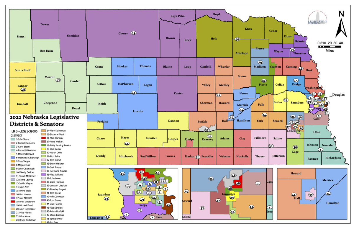
State Senator: Dave Murman (District 38)
Standing Committees (click for scheduled committee hearings):
Select Committees:
- Committee on Committees
Map and statistics for Legislative District 38
Map of all districts in the Nebraska Unicameral Legislature
Nuckolls County History
Number of Registered Historic Places: 7
Year Authorized: 1860
Year Organized: 1871
Etymology: Nuckolls brothers (Lafayette and Stephen, legislator and businessman/slaveowner, respectively)
Prior to being organized in 1871, the area which today is Nuckolls County was the scene of some of the most fierce Indian raids ever recorded in the south central portion of Nebraska. The largest raid, recorded on Aug. 7, 1864, is said to have stretched from Gage County to Denver. By 1867, the area was virtually abandoned. By the 1870s the situation had greatly improved and settlers once again began to inhabit the area.
Nuckolls County is named in honor of the Nuckolls brothers. Lafayette Nuckolls, at age 19, became a member of the first Territorial Legislature while his brother, Stephen, was a pioneer Nebraska settler, businessman and banker.
The Little Blue River, which passes through the northeast corner of the county, led to much of the settlement that pre-dated the Indian raids. Mormons passed through this area on their way to Salt Lake City. Thus the Oregon Trail was created and in 1858 the government began using it for transporting supplies to frontier military posts. The following year the Pony Express began following this route.
E.S. Comstock is widely credited for the early development of this area. In 1856 Comstock established the first stage station at Oak, along the Little Blue River. Eventually a post office and a Chicago and Northwestern Railroad station were located in Oak. Following the Indian raids and subsequent return of the settlers, the area began to prosper.
About this same time the county's boundaries were established by the Legislature, although it was be another 11 years before the county was officially organized. The county's first election was held June 21, 1871 under a giant elm tree near the settlement of Oak. For the next several years, all county business would be conducted from the home of D.W. Montgomery, who had been elected surveyor. In 1874, as the population began to spread over the county, voters selected Nelson as the county seat. Nelson, which was surveyed only the year before, was located in the center of the county and was more accessible to settlers.
Highlight an important program in your county in this space! Send an email to:
Local Highlights
License Plate Number: 42
Time Zone: Central
Zoned County: No
Number of Veterans: 358
Number of County-Owned Bridges: 219
Number of County-Owned Dams: 1
Election Data
General Election Turnout (2022): 51.30%
Total Registered Voters (2020): 3,225
Number of Precincts (2020): 8
Number of Election Day Polling Places (2020): 6
Land Area per Polling Place (avg.) (2020): 95.86 sq. miles
Intergovernmental Data
Emergency Mgt. Planning, Exercise and Training (PET) Region: South Central
Natural Resource Districts: Little Blue NRD, Lower Republic NRD
State Lands (acres): Smartweed Marsh WMA (160.22), Smartweed Marsh West WMA (38.57)
Sources: Nebraska Department of Transportation, Nebraska Emergency Management Agency, Nebraska Game & Parks Commission, Nebraska Legislature, Nebraska Office of the CIO, Nebraska Secretary of State, U.S. Department of Veterans Affairs, U.S. National Archives and Records Administration (eCFR)